
Drone Technology in Agriculture: Smarter Monitoring from Above
- Terence Patlunag
- Feb 18
- 2 min read


Modern agriculture depends on precision, efficiency, and timely decision-making. With acres of farmland to manage, it can be difficult for farmers to spot issues early using traditional ground inspections alone. This is where professional agricultural drone services from AeroVid Drones deliver a powerful advantage.
The aerial image above highlights how drone technology provides a comprehensive view of farmland—revealing field patterns, crop layout, terrain changes, and drainage paths that are nearly impossible to assess from the ground.
Why Aerial Crop Monitoring Matters
From above, subtle issues become visible before they turn into costly problems. Drone-based agricultural monitoring allows farmers and land managers to:
Identify uneven crop growth and stressed areas
Detect drainage problems or erosion patterns
Monitor soil conditions and field layout
Track seasonal changes across large acreage
Improve planning for irrigation, planting, and harvesting
By capturing high-resolution aerial imagery, drones provide insights that help optimize yield and reduce wasted resources.
Seeing the Bigger Picture with Drone Imaging
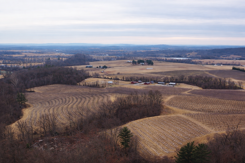
Aerial view of farmland in York Springs captured by AeroVid Drones
The featured aerial photo demonstrates the true value of drone monitoring—showing entire fields in a single, detailed view. Curved planting rows, elevation changes, and field boundaries are clearly visible, allowing farmers to make informed decisions with confidence.
Unlike satellite images or manual inspections, drone imagery offers:
Higher resolution
On-demand scheduling
Flexible flight paths
Accurate, up-to-date data
This means faster insights and better results.
Safer, Faster, and More Efficient Than Traditional Methods

Traditional field inspections can be time-consuming and labor-intensive, often requiring vehicles or walking long distances across uneven terrain. Drone inspections eliminate these challenges by safely surveying farmland from the air—without disturbing crops or soil.
With AeroVid Drones, farmers receive:
Minimal disruption to operations
Rapid data collection
Clear visual documentation
Reliable monitoring throughout the growing season
AeroVid Drones: Precision Agriculture from Above
At AeroVid Drones, we specialize in providing professional aerial imaging solutions designed to support modern agriculture. Whether you manage a small farm or large agricultural operation, our drone services help you monitor land efficiently and make smarter decisions backed by real visual data.
📍 Agricultural Monitoring Services Include:
Crop health observation
Field and acreage mapping
Drainage and terrain assessment
Seasonal progress documentation
Ready to Elevate Your Agricultural Insights?
If you’re looking to improve efficiency, reduce risk, and gain a clearer understanding of your farmland, AeroVid Drones is ready to help.
📞 Contact us today to learn how aerial drone monitoring can transform the way you manage your land.


Comments